
Digital Cartography | Eric Fischer
“Ultimately, almost everything I have been making tries to take the dim, distant glimpse of the real world that we can see through data and magnify some aspect of it in an attempt to understand something about the structure of cities.”
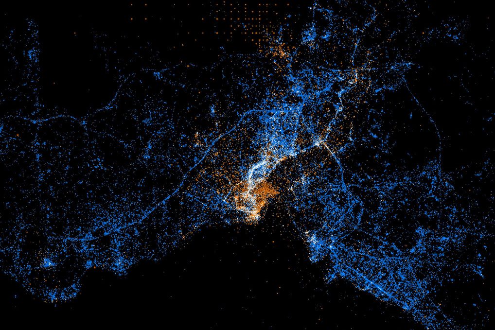
Locals and touristsOne of the motivations for the project ‘Tourist Information Rotterdam-Istanbul” was undoubtedly seeing the ‘Locals and Tourists’ maps of Eric Fischer. He made a set of maps from the photos taken in different cities by locals and visitors using the data from Flickr and Picasa search API’s. Red points, showing the locations where photos are taken by visitors, are also the spots and routes that can be find in every tourist guide of Istanbul and Rotterdam. The places photographed were so fixed and specific, that we want to explore the possibilities to extend the way of looking to another city, or your own city. By creating new images, routes and presenting the city in a broader way in the context of tourism. Like Eric Fischer himself says “What I think this really established was that each city has a few streets, areas of shore, or scenic outlooks that are core to its identity, and you can tell which they are by the places that people take pictures of over and over again.” and “where the edges are where people turn back and stop exploring”.
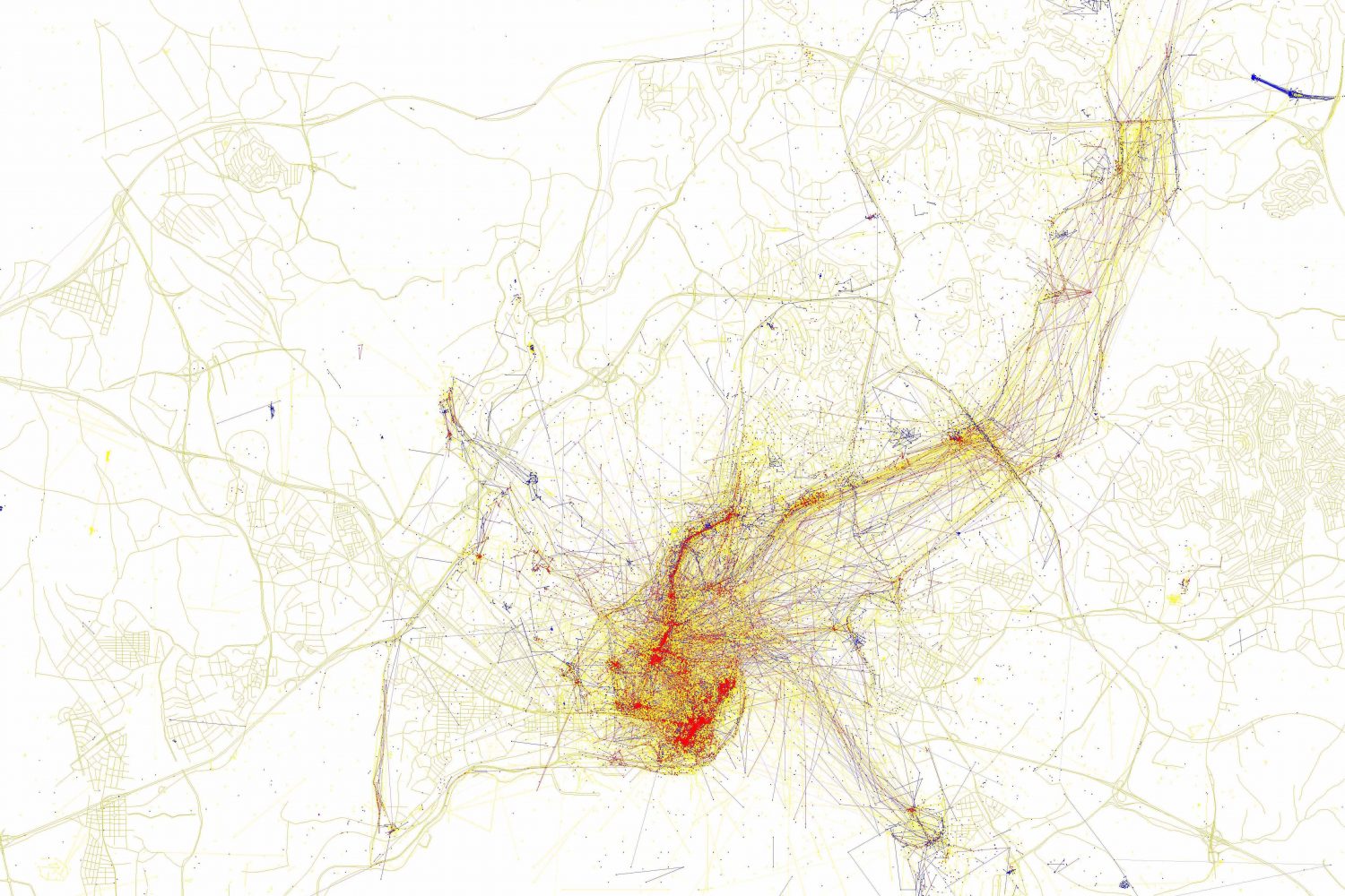
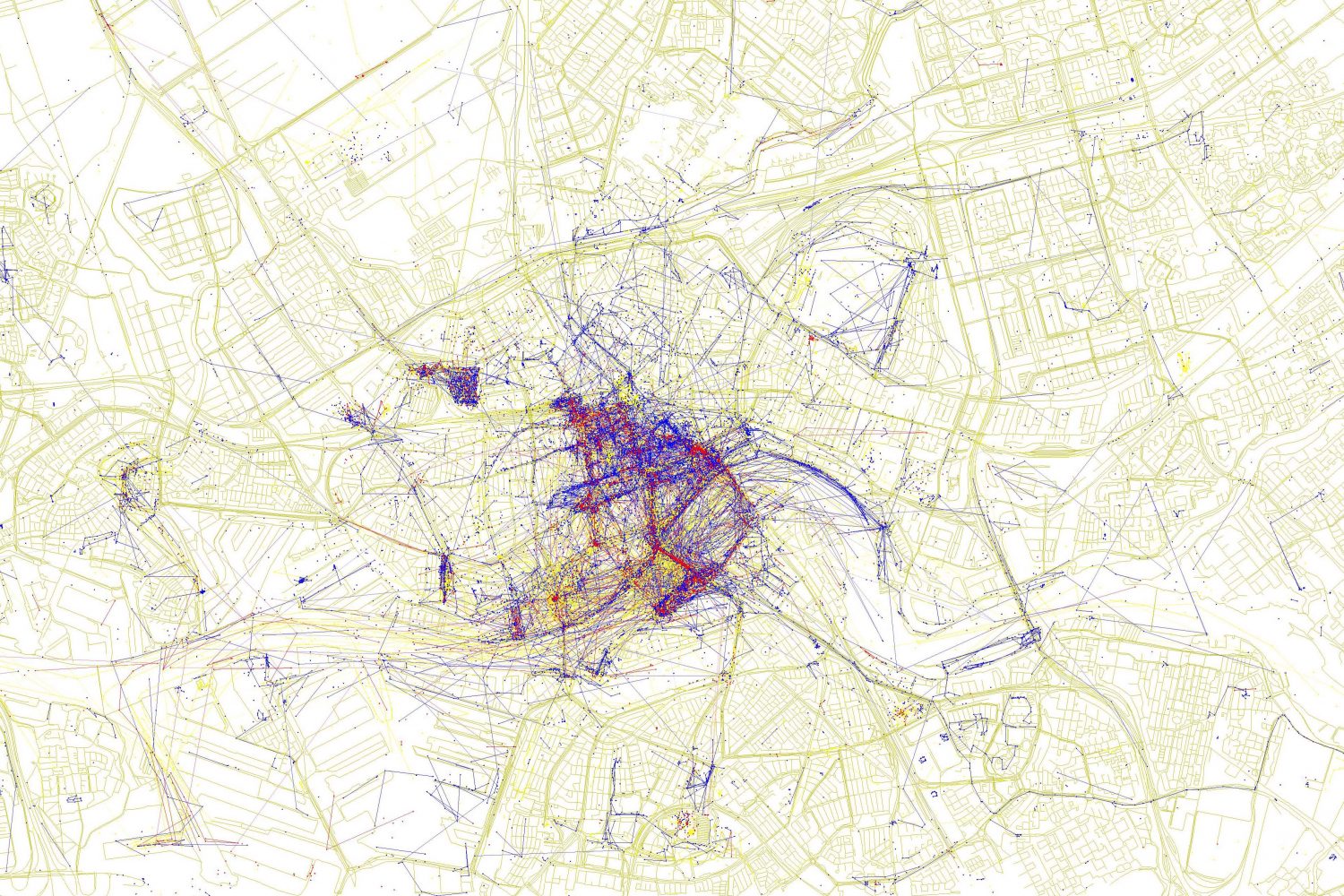
Visual reflectionsIn his Twitter account, Eric Fischer describes himself as a “geek of maps, data visualization, failed transportation plans of the past, history of technology, computers, pedestrianism, and misspelled street signs”. Till now he made several maps about different themes, from race to language. He does not consider himself a cartographer, he makes visualizations. By collecting pure raw data, he does not take conclusions but only a reflection of data. Next to his visually striking ‘See something or say something’ maps based on geotagged photos (Flickr) and tweets (Twitter), last year he created a set called ‘Paths through cities’ using randomly chosen geotags. Following these ‘new’ routes is maybe an interesting way of exploring a city?